Land cover in mountainous regions is changing due to factors like climate change, extreme events, and evolving land use practices. For instance, rising temperatures are enabling forests to extend to higher elevations, shifting the tree line upwards. At the same time, higher temperatures are also causing permafrost to melt, leading to increased rockfalls, which in turn impact pioneering vegetation. To monitor these changes, a range of near and remote sensing techniques are used.
During this summer school, organized by the University of Innsbruck, approximately 50 scholars gathered to exchange knowledge and explore the latest applications of terrestrial, mobile, and permanent laser scanning. Our fieldwork took place in alpine Pinus forests, bogs up to 3 meters thick, and steep rock faces. We learned how to collect, process, and analyze point cloud data generated in these challenging terrains.
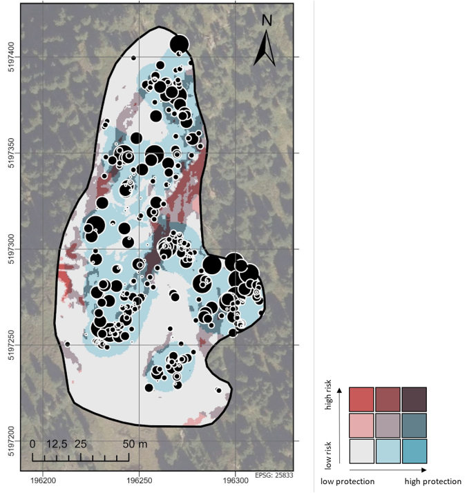
I participated in a group focused on forest structure and its role in mitigating rockfalls. Our research found that both mature trees and deadwood can significantly reduce the kinetic energy of falling rocks. The study site, a sparse Zirbenwald (Arolla pine forest), had low stem density (117 stems/ha) and biomass (21 Mg/ha), composed solely of Pinus cembra. This species, known for its relatively soft wood (0.42 g/cm³), thrives in the harsh climatic conditions of the region (mean annual temperature of 3.4°C and 903 mm of precipitation), where few other tree species can establish. Although this sparse forest offers limited protection against rockfalls compared to denser, and more species-rich stands, it still provides more protection than open grasslands.
It was an enriching experience to connect with motivated peers using similar tools for forest quantification, like I use in the SUSTAINFORESTS-project. Laser scanning technology and associated software for point cloud analysis are rapidly advancing and becoming a reliable tool in various fields.

Fig. 1 Map of the study area indicating the overlap of rockfall risk due to slope and rockfall protection due to basal area. The black points indicate tree positions and their diameter.

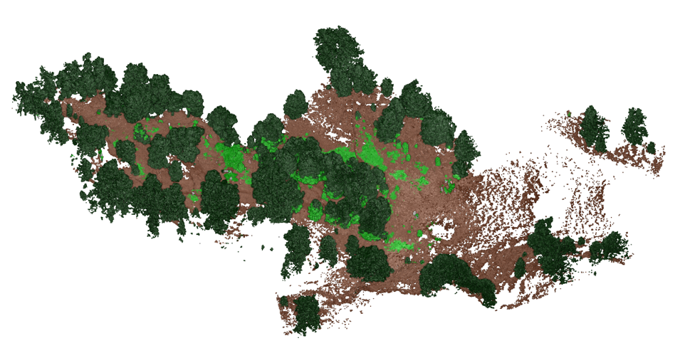
Fig. 2: Forest as visualized by point cloud taken with terrestrial and mobile laser scanner. Dark green Pinus trees, bright green shrubs, and brown ground points.
